Saturday 27 October 2012

A walk to Glaramara, our own RAF display and a tumble.

Mondays and Thursdays are holy days for me now, they are my two days of the week where I set out to walk in the company of fellow retirees and former colleagues and 25th October was such a Thursday. We will go out irrespective of weather as a general rule, to do otherwise means our level of fitness would suffer and others may have work commitments on other weekdays. We met at my house at 07.30hrs and set off for Seathwaite, a 45 minute drive coming from the Carlisle area. The weather reports boded well and we were not disappointed with the morning's early display as we headed down Borrowdale, the morning mist thinly lining the lakes surface.


Catbells beyond a serene Derwentwater.
 
It is difficult to resist a turn onto Kettlewell car park and thus we turned to take in the view of Catbells, across the lake. As we progressed further along the valley after this impromptu stop we were enveloped in the mist yet could make out the fell tops through this thin veil. One could only imagine the view of Borrowdale and Skiddaw you would get on such a day from Castle Crag, but that was not our destination so we continued on. We headed deep into the valley, turning left for Seathwaite and we were some of the earliest there. We parked very near to  the farm and took in the views of the broken mist on the fells all around, the dogs were keen to make a start and the three of us set off towards Stockley Bridge for my favourite route to Glaramara. Most people take the Combe Gill route to this summit but I much prefer the more challenging and shorter Hind Gill route. It is accessed by turning left at the gate just prior to the wooden bridge that crosses Hind Gill, this bridge being approximately half way toward Stockley Bridge from the farm. Be warned, it is directly up and will tax weaker legs, though if you wish, frequent stops will be rewarded with stunning views to Taylorgill Force and Seathwaite Fell for those who take the time to turn.

 
Seathwaite Fell and Taylorgill Force, enveloped on it's plateau by the morning mist.

 
The farm hidden in the receding mist. Seatoller Fell and Grey Knotts as the backdrop, Dalehead on the distant horizon.
 
Both the above pictures were taken on a stop to remove outer clothing as the route up was pumping the heart, a real calorie burner. We continued on along the path which had quickly crossed the gill so we were holding this to our left. You go through a gate in a wall running horizontally along the fell and continue up, the steepness not relenting though at times on true rock, not grass routes. When the path finally begins to diminish in it's steepness you suddenly realise it seems to have disappeared. If you still hold to the line of the gill though, you will finally meet up with the more common Combe Gill route as it winds it's way up and beyond Thornythwaite Fell. We took a shortcut angling slightly to the right, as our summit was in sight.

 
Looking back to Base Brown, Green and Great Gable beyond the Seathwaite Valley, Hind Crag framed by the remaining wisps.

 
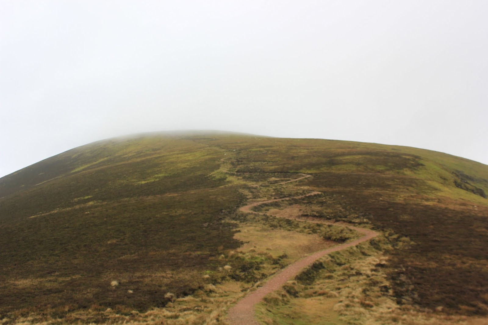
Two of the team of three, summit ahead.
 
This is a lovely fell with excellent views of Borrowdale and Skiddaw opening up prior to the summit.  There is a slight sting in the tale just prior to this summit though, a final scramble up a rocky outcrop before a 360 degree vista opens, taking in The Langdales, Bowfell and Great End to the east and south, to complement the previously mentioned northern views. This scramble can be avoided either to the left or right though the actual marked path takes you up through this.


Scramble route to the summit.

 
The summit cairn to our right from the scramble. 'The Beast' was first up and waits for the rest of the party.
 
Once on at the summit we took a bait stop at the horseshoe shelter just by the cairn. It's worth the time in good weather to take in these views. Those who think of the valleys of Langdale, Wasdale and Borrowdale being great distances apart are thinking as a car driver. As a walker they are actually quite close and it dawns on the inexperienced when at this summit.
 
 
Great Gable and the view to Wasdale.
 

Our next summit was to be Allen Crags, then to move on beyond the valley junction that is Esk Hause to Esk Pike, before turning back to take in Great End, intending on dropping down The Band to Sprinkling Tarn, onto Seathwaite Fell and finally back to the farm. I say intending as we never managed this final fell, but more of that later. Glaramara is an easy fell to get disorientated on, there are a number of false summits that walkers aim for which can draw you away from the marked path. I mention this as there is one rocky outcrop where the path way is easy and any other is a possible fall, so do this fell in good weather if not used to it. We reached Allen Crags and the southern view, which was temporarily obscured, returned and opened up our route to Esk Pike.
 
 
Allen Crags summit achieved.
 
This was for Ruth, a former colleague, her first time on these fells, which had been the main reason for this as a chosen route. That said though, as we say, "A walk is a walk, is a walk" and the varying views are tremendous. It may not be a classic, 'Wainwright bagging walk' but why should it be? Although we were engaged in tidying up some summits Ruth had not been on, for us other two it was a 'miles in the legs' walk, we were after all, out in 'God's gym'.
 We moved off to pass Esk Hause where two wild campers were perched. This Hause is the classic fell pony route for the three valleys of Borrowdale, Langdale and Wasdale and is the highest hause(high point between two valleys) in the lakes. Consequently it is just a short uphill section to Esk Pike, this normally being associated with the Langdale valley/Bowfell range.
 
 
A further Wainwright summit, Esk Pike viewing the southern side of the Scafell range.
 
This was our furthest point we would be from the start, we then turned back heading for Great End and Seathwaite Fell. It was now that we were to experience our finest moment of the walk, shortly to be followed by our worst one. Two to three minutes of walking, returning broadly down the path we had ascended on, we heard the roar slowly building and realising what it would be I quickly moved for my camera and was in position for the crescendo that was two phantom jets arcing through Esk Hause, banking to head toward The Great Moss and Hardknott Fell area before disappearing in what seemed but a moment, along the Duddon Valley.
 
 
RAF jet viewed from Esk Pike, Great End to the right.

 
Roaring away on an 'Op', heading toward The Great Moss', another jet soon to follow behind.
 
 Throughout 28years as a police officer I've been to a number of tragedies where these have crashed usually with fatal consequences. We held great respect for the pilots and the risk they put themselves to, training within this mountainous terrain to hone their skills if ever they are needed in a real incident. It must be fun though and the ultimate 'boys toy'!.
 Once out of view we put away the cameras to move off down the rock descent and then it happened. The next step taken by Ruth was a slight misjudgement where she caught her foot on a rock protrusion, tried to redress, lurched forward to hunt for a foothold and tumbled down toward jagged rocks below her. This was bone breaking terrain which she hit, bounced, rolled and fell further onto more jagged rocks before coming to a stop. You could see she had tried to get an arm out to break the fall and on both bounces had managed to do so, though I don't know how she did. Think of any bone in the body and you could easily break it with such a fall skull included, but as we dashed to her  she was conscious, and capable of moving all her limbs, though clearly dazed. She insisted on standing and was in a great deal of pain though thankfully only muscular, mainly to her upper thighs and the back of her knuckle. Having tumbled, that was a positive result on what appeared as an obvious MRT incident. Despite strong suggestions from us she refused to call it a day and make our way down, insisting on moving on to Great End. She was satisfied it was just bruising and wanted to keep moving. I've come to know this young lady over the last 10yrs and the way in which she drives herself to achieve anything I hold in the highest regard. She was in pain but continued on with nothing more than an Ibuprofen tablet to dull it. We got to Great End summit and finished our bait with one final stop at the cairn.
 
 
Ruth in blue and this is after the tumble.


The central gulley of Great End as viewed from the top.
 
 
Great End summit.
 
It was clear that the pain was kicking in at the cairn and time was starting to be our limiting factor, so rather than The Band steep route off toward Seathwaite Fell, we decided on the longer but more gradual route off via Calf Cove and back to the farm by Grains Gill. This missed out Seathwaite Fell, but it's still there for another day for her to set her sights on.


Looking toward Grains Gill, Derwentwater in the distance.
 
The weather was closing in, having had the best of it in the morning and the route down was uneventful, returning to the car after just over 5 hours walking. This was 15kms and just over 1200m ascent, so a decent trek out, though not a big one, by our normal standards.
 
 
Seathwaite Farm as viewed on the return leg.
 
 Now a walk in company is not a walk completed until you've supped some ale and this we did at the Scafell Hotel Walkers Bar at Rossthwaite. It can be a little 'samey' but there is a good selection and it is always well kept beer. A good walk, a very eventful day. How's Ruth I hear you ask? That lady was walking having completed a night shift and was back in on nights that very night. As I said, I've a great deal of respect for that lady, 'driven' is what she is.


Tuesday 23 October 2012

Sail, Crag Hill, Grassmoor, via Mill Beck.

For a while now I've been looking for routes within the cumbrian fells that are not normally covered by others to give variations on classic routes. I have covered the routes to Grassmoor and also those to Crag Hill(Eel Crag) from both Braithwaite and Buttermere/Crummock on a great number of occasions. There is a valley that I have walked only once about eight years ago and have kept meaning for a re visit and this time to use it for a route up onto these aforementioned fells. The valley is the Mill Beck, Sail Beck, Addacombe Beck route, between Whiteless Pike and Knott Rigg. This is a route that takes a walker away from The Newlands Valley road, if you want to walk from Buttermere to Braithwaite and keep off tarmac and steep inclines. Our intention was to use it as a route into the fells before doubling back over Sail, Crag Hill and Grassmoor to return to Buttermere.
 The two of us parked up above Buttermere Church. The two dogs were in the cage in the back and had whined with excitement once through Lorton and were getting a backward view of The Mosser Fells and Hopegill Head. The sight of mountains sets them off; it's nice to hear but after 15minutes of whining, you're getting sick of it.
 We set off heading down to the gate directly opposite The Bridge Hotel that gives access to the track running up the north side of Mill Beck which leads through the oak wood to the stile over the drystone wall which we would then follow. You can also park at the National Trust car park in Buttermere, the footpaths will converge near the Stile.

 
Millbeck and it's oak wood, heading for the stile.

 
'The Beast' about to bound up the stile. The wall is the marker to then follow to the right.
 
The walk from here on is not our normal 'out of the car and straight up something steep' walk or as we refer to them 'as the crow flies' route to the summit. This is a long, gentle, ascent to the valley head before a short upward climb through heather to the crossroads of paths between Scar Crags and Sail. Be aware that the route seems to divide into two paths on Whiteless Breast. The lower 'path' follows the line of the beck but goes through reeds and swamp. We took this initially though can't say quite where. The path proper is above the reeds line and best described as , 'if there appears a path above you, then that is probably it'.
 
 
Sail Beck meandering to Mill Beck, Ard Crags to the right, Sail to the left; Causey Pike's distinctive buttress framed by the valley head. You can just make out the higher correct path and the lower incorrect one.


Addacombe Beck, with Addacombe Hole above. This looks like an interesting route to try to access Crag Hill from as another route up to these high fells.
 
Although not the sunniest day, it had been dry up to the valley head, but as we branched off to the left for the paths junction on the east side of Sail, the cloud began to descent and envelope us so we switched to waterproof jackets whilst in the mist. As I stated earlier, I've walked the valley path once before but this ascent to the path junction was a first time for me, albeit a short section. I was surprised at the erosion on this with deep gouges in the soil, at times at knee height. I assume this is caused from walkers wearing away the foliage and water washing gullies into these walked areas exposing shale underneath the topsoil.
 We were now on territory very well known to us, being regular traversers of The Coledale Horseshoe; although cloudy this route is committed to memory no matter what the weather. We turned for Sail and it's new 'fix the fells' winding path that is correcting the erosion caused by walkers and mountain bikers. Some regard this as a bigger scar on the landscape than the erosion it is attempting to counteract, but I believe it is it's newness and in time the banking will blend in as similar paths on Scales Fell and Blease Fell have now done.
 
 
Sail, with it's new path. You canjust  make out the direct descent route that used to be the eroded path.
 
We made our way up this by getting our head down and ticking off the eight bends on the right and nine on the left. It's a way of not looking up while the heart is pounding but knowing still how close you are to the top. The summit cairn is just visible to the right at the top of this, the path not actually passing over the fell top.
 
 
Dillon "I don't care, this is top enough for me!"


Beyond Sail we made our way along the craggy Scar. It's a walk though occasionally you need to get your hands on the rocks to assist; safe though.
 
 
And then we make the barren landscape that is Crag Hill and it's trig point.
 
We were intending on having a bait stop here but the wind had picked up. Our next fell top was to be Grassmoor and there is a spiral, three spoke shelter on it's summit giving some protection from the wind. This wasn't fierce by any means but good to shelter from when at rest and differnt from our last visit in January when we were getting blown over in iced conditions. To this point we had not seen a living sole though began to meet others coming off Grassmoor, with a lone walker also at the cairn who was engaged on his version of The Coledale Horseshoe. Grassmoor is another barren landscape fell with no distinctive features to assist you off. The Lad Hows path is a difficult one to locate if you can't catch sight of the ridge it descends, but we knew it well enough and soon located it in cloud. Once on the ridge you can't really go wrong and we very quickly began to get out of the mist with the Buttermere valley opening up before us.
 
 
Lad Hows, Whiteless Pike to the left and beyond in cloud, Haystacks and High Stile range.
 
I love the vista of Buttermere, Crummock Water and Lowswater you get off this route, with High Stile, Great Gable, Pillar and Robinson always in view as you walk down. The botton of this path leads to the famous Rannerdale and it's shock of historic bluebells 'blueing' the valley floor when viewed from on high. If ever you take this as a route onto Grassmoor however, beware. It is a relentless slog as it is one of those rare routes where you can see the fell top from the valley bottom. You never seem to get any closer no matter how long you walk, but in that regard it's a spirit tester and worth the effort; you can always rest, turn and take in this view.


"Come on, hurry up you of only two legs!"
 
Here we have Crummock and Melbreak, with Lowswater and the Mosser Fells in the distance.
 
Once at the valley floor we had two choices, over the top of Rannerdale or up Squat beck, in other words, steep or gradual. I had been out walking the day before and was feeling this. The two of us have put some long walks in recently which have made us unpopular at home, landing back at 19.30hrs and 20.30hrs(when we had said we would be back for 17.00hrs), so we opted for the quicker Squat beck route to score brownie points. This is a beautiful gradual incline up a valley between Rannerdale Knotts and Whieless Pike, but I hope to cover this better in the bluebell season so will leave it there. When at it's head we then dropped to meet our original path again, at the Stile.


The descent through the oak wood at Millbeck, same path, different direction.
 
 
.... and finally, out onto the Buttermere raod opposite The Bridge Hotel before the short tarmac trek to the car.
 
 This was a worthy walk of 15kms with 1200m ascent, not the biggest, but good enough after a 17kms yesterday. Try it, it's different, the views tremendous, you'll like this.
 I say .... and finally, well, not quite. No group walk is complete without a trip to a pub and it wasn't to be The Bridge or The Fish. If we are ever near it, the pub for us is The Kirkstile Inn, an iconic public house just at the foot of Melbreak and Lowswater village. It has it's own microbrewery, though these days the brews are done at Hawkshead, the brewing room now converted to an eating room; incidentally, my mate says they make the best steak and ale pie he's ever eaten and I can't disagree. This and heavenly micro beers, why would you go anywhere else? 


Monday 22 October 2012

Carrock Fell to Great Calva social media hike.

Sunday 21st October was a walking day on Carrock Fell, organised by the irrepressible Gina @CumbrianBlondie and her hubby Dave @Kendalskintcake and Gary @northlakesuk. Although a smaller turnout than previous occasions, this was a brilliant day for walking, including the weather, company and terrain. 'The Beast' was packed in the cage and I drove once again via Bluegate Crossroads above Caldbeck. The view in the early morning light was breathtaking. I have witnessed this sight for 26yrs, sunrise and sunset and still it takes my breath away.

 
The drop down into Caldbeck from Bluegate Crossroads.

 
Approaching Carrock Fell from Heskett New Market, this would be our first fell.
 
 We met up at the Ford at Carrock Beck & decided on a two car approach so left one at Wolfram mine, Swineside and parked the others at the base of the steep path just off the road NY354338 and set off up the ever increasing incline. A very good route over rocks and scree and a good blowout of any lingering drink effects from the night before, my best route onto this fell.
 
 
Click on the image and you will see the track angling from the right and heading for Further Gill Syke.

 
Three trees acting as sentinels for the route up.

 
Looking East toward the Eden valley and The Pennines.
 
 
Now it is at this point of the walk that a serious injury occurred with a slip by Gina causing severe bruising to her Tweeting thumb muscle. It looked sore, but hopefully nothing broken. It was also the point in the walk where Dave noticed an effect in the thin clouds with the morning sun behind. I managed to get a shot of this, not looking down the eyepiece of course.


I can't recall ever seeing this before and well worth the walk just to see and record it. I've seen glorious rainbows and a Brocken Spectre, but not this feat of nature. We moved on taking in the iron age ring encampment that is all but destroyed. As normal I forgot a photo of this feature, though fair to say it can't really be seen in one. It takes the eye to view all around, work it out and let the mind see it, no one photograph can show it.


From Carrock Fell our next summit of High Pike and it's trig point were in view.
 
For those unaware of the terrain, the surprise comes from such a craggy summit to suddenly wading through peat bogs all the way to virtually the summit of High Pike. Myself and Gary have covered this fell so knew what to expect.


The summit of High Pike. This is Gina and I believe she is tweeting the fact that she can no longer tweet. Nothing keeps a good girl down for long!
 
 
We moved on after taking in the tremendous views of Caldbeck, the north Solway Plain and a discussion with a few others walkers on High Pike. We were setting a good pace, but were impeded by this Shepherd moving his stock toward The Knott, our next destination. That said, who could not 'stand and stare' at fell life continuing through history albeit with the modern aid of a quad bike. We managed to move quickly and were happy to catch up to a fellow walker though could see he had a year or two on us. We gave him some top walking points and marked ourselves down on the fitness points when we found out he was 86years of age and tramping on. The next feature you come across is the Lingy Bothy, a wooden shed that people sleep in on the fells. There is a visitors book and some left over candles etc. After a marked up visit in the book by Gina we continued for our next summit and a bait stop.
 
 
The Shepherd, his dogs and flock, oh and a quad bike.


Viewing back to Lingy Bothy Gina and Dave nearly 'holding hands'.
 
 
A bait stop on the summit of The Knott. 'The Beast' looking aggrieved that she's not been given hers yet. Here we once again were treated to PrincessG's heavenly brownies and with people not in abundance that meant, seconds.
 
After entering into a conversation with another walker and wishing we hadn't we cracked on for Great Calva constantly checking back that he wasn't catching up to bore us to tears anymore with his football tails, a game he didn't really follow but never shut up about. Unfortunately he was catching up, so we hit top speed and managed to draw away, to the last fell in our sights. Great Calva summit is once again a rocky outcrop and gives excellent views of the back of Blencathra and Skiddaw, including Skiddaw house, an old shooting lodge for Lord Lonsdale.
 
 
Great Calva on the right with a view of Glenderaterra Valley, framed by Blease Fell and Lonscale Fell, as seen from The Knott.

 
The summit cairn of Great Calva, Gary photographing me, photographing him. Bowscale Fell framed by the cairn and him.

 
Our route down the fence line and the river Caldews beginnings, heading inextricably for Carlisle and the Solway.
 
 
Once down the bottom (incidentally I slipped after telling others it could be slippy), we crossed the beck and headed down the Cumbria Way route where the benefits of parking the car at Wolfram mine became apparent. If I'm fell walking I like to be on fells or tracks, not tarmac. A road was put in the valley for the mine and I'd rather drive it than walk it. This mine no longer works but when it did it was for Tungsten. It was only ever viable as a dependable source in times of war, so lets hope it is never needed to be opened again. A good walk of 16kms and 850m ascent, a good day out on rock and peat bog, in good weather.
 After a short car journey we were reunited with the other cars and a quick trip to The Mill Inn, Mungrisedale for the reward of two very good ales in this Robinsons Inn. We said our goodbyes and headed home with another meet arranged, if all can make it, for Wetherlam on 28th.


Friday 19 October 2012

Loft Crag, Pike of Sticle & Stake Pass. The Langdales.

This is a 'follow on' from my earlier entry regarding High Rigg in St. Johns in the Vale, though being a quite separate valley and fell range I thought it better to separate them. We headed into Langdale through varying weather to The Old Dungeon Ghyll and due to the lateness of the morning decided to eat our bait before heading up. Our destination was specifically Loft Crag as my colleague had missed it when in The Langdales, though at the time wasn't working through a Wainwright list. With the dogs we cut through behind the hotel heading for the route leading below Gimmer Crag, giving access to Loft Crag, though one may as well make a walk of it and we were going to continue on, though whether to the left or right we were undecided at this point. We read the signs indicating path erosion so decided to avoid that route, our original plan still seemed sound. We cracked on up the steep well made path and before we knew it were on the scree path we had decided to avoid. We were thrown by a new fence and gate so thought we had to be right, but after my colleague climbed a big rock outcrop we decided it was the route told not to take. It seemed safer for me to climb than him lower himself down, so up I went after manhandling The Beast up the outcrop. Now, for those who have walked with me, you know if The Beast can't manage it, it has to be awkward and with two hands engaged I could only use the top of my head to push the dog up by easing it up via it's backside. This involved rolling my head so face was uppermost and raising further on my tiptoes. Imagine the scene, The Beasts backside millimetres from my clenched lips, but it's front crampons finally got the purchase it needed and off it went. No photo of this, thankfully!


Our track up behind Old Dungeon Ghyll. Side Pike opposite. We were on this a month ago and a cracking small fell it is, giving access to Lingmoor Fell.

 
Here you can see our mistake, a well made path through the gate above and up the piece of fence behind. Wrong move.


This is past the 'dogs behind in the face' incident and you can begin to appreciate the steepness.
 

I was starting to get a bit of vertigo here and we had at times to scramble up steep grassy banking, so it was 'don't look back' time. Always forward, the ground eventually eased to a more walkable slope and we eventually crested onto the well made up path for Loft Crag and much happier I felt for it.
 
Once on the plateau this erratic rested last disturbed only by an ice sheet thousands of years ago. To take in the significance of this, before man could know of such things his only explanation was Giants & Trolls put it there, a part of folklore throughout the county.
 We turned and continued on for Loft Crag via Thorn Crag, taking this and it's view of Blea Tarn in first.
 
 
Thorn Crag with the path to the left.

 
The view from Thorn Crag with Lingmoor Fell to the left, Blea Tarn centre and Wrynose Fell(leading to Pike of Blisco) on the right. Windermere is far left and Wetherlam in cloud.

 
One view of Pike of Blisco with the Sky improving.

 
A second view, more cloud but heaven shone through.


We were set then for Loft Crag, our real destination, it and Pike of Stickle could clearly be seen as above. The path was well marked and I have walked this a few times this year. We got to the summit but as is my error occasionally I didn't photograph the cairn and it's background drop.


I remembered on the route toward Pike of Stickle and managed this photograph looking back. With the sun on it's western face I believe I got the better photograph here.
 
Between Loft Crag and Pike of Stickle looking to the Langdale Valley and Pike of Blisco. Was this where we should have come up? I'll find out next time.


We got onto Pike of Stickle and after the ascent got one of the best views of the day, with Loft Crag beyond the summit cairn, Harrison Stickle to the right, Lingmoor Fell and Blea Tarn behind, with Winderemere filling the distant horizon. It may not have been the best weather day, but still a good view and worth the climb. Time to move on now for Stake Pass and Langdale Combe as the route to the valley floor, by the Martag Moor path.
 
 
We picked the Stake Pass path up to the left(as you head down) of Langdale Combe. I love viewing these moraines and was hoping to catch them in low sunshine to enhance their contrast against the landscape. This was not to be, or if it was it was eating into pub time at The Britannia and you've got to be sensible here.

 
This is a 'stitched' panoramic shot looking back to the head of the Combe showing the full extent of the moraines.

 
The Stake Pass view down the Langdale Valley and Pike of Stickle to the left.
 
 
Without incident we descended the Pass taking in the view of Bow Fell and The Great Slab(to the left of the 'V'). I'll have to get back on that one day soon. Although not as long as The Langstrath Valley it is a long way still, back to the Old Dungeon Ghyll car park. Incidentally, the clue is in the name for both valleys. 'Lang' is cumbrian dialect for 'long' and so you have Longdale; it makes sense now. (I only say long when trying to be posh and that's not often).
 
 
A final shot of the valley and Pike of Blisco to remind us that it seems always at the journeys end that you get the best of the weather. We make the car park after just short of 10km walk with 700m ascent. With the earlier walk up High Rigg, this amounted to about half our normal distance but I have to confess it was a Wainwright bagging walk. One more to go and that is it.
Q. Which one?
A. Muungrisdale Common.
Q. Why that one?
A. Because it's a small one, journeys end, more pub time, a beer festival in Carlisle and a mates retirement do round the corner to finish off on. It's a celebration plan!
 
 Speaking of drinking the walk isn't over as the celebratory couple of pints were downed in The Britannia at Elterwater, a gem of a pub. Walk ended. I love this life!