Sunday 17 February 2013

Crag Fell, Grike & Lank Rigg, Ennerdale.

Thursday 31st January saw three of us in the Ennerdale area of The Lakes. One of the party had never been on the Grike range to the west of Ennerdale. This was my second visit this year and I was interested in changing our previous route slightly to take account of the path on the far shore of Ennerdale Water, a path I had not previously walked. We parked on the Bleach Green Cottage car park, on the south side of The River Ehen and headed past the cottage toward the foot of the fell taking the track that veers to the right of Crag Farm House, heading for the gate.


Setting off.
 
 
The weather was not as good as the forecast had indicated, or we were being too optimistic, however it didn't appear to be about to rain anytime soon, though it was cold. The clouds were off the fell tops so it was to be a walk where we could navigate by sight.
Once through the gate we aimed slightly to the right and picked out the worn track (not marked on a map, but very distinctive) that goes directly up and connects with the footpath through the wood which then goes over Ben Gill by the waterfall. Our first destination was to be Crag Fell, with the intention of heading to Grike, then dropping off the back to Lank Rigg.
 

The view over Ennerdale Water and the weir with Bowness Knott and Great Borne on the far shore.


Striding out for Crag Fell.
 
The snow was just clinging to sheltered areas of the fells and these are all rolling fells with no crag faces to encounter so we expected no safety issues, we all carried trail spikes and I had an ice axe for overkill. Both dogs were loving this outing being grass to run about on and soft on the paw. The summit of this fell is never quite in sight until you are just about on it, but the near top is in view whereupon it flattens to a gradual and easily manageable incline, so it was 'heads down and crack on' time.
 
 
Crag Fell Summit
 
None of these three fells rate in the most dramatic fell category of lakeland peaks, though you do get the contrast of the fells and the solway plain that skirts between the coastline and the National park. They also afford you views across to Galloway and to the Isle of Man when the views are clearer, though not today unfortunately. Being a west cumbrian I was not here to glimpse these, having had a lifetime of looking at them, though I am struck by how others take time to soak in what I have taken for granted all my life. What I personally enjoy from these vantages, is the different aspects looking to the Buttermere ranges and to Pillar. Ennerdale is a much more secluded valley than say Langdale or Borrowdale, the only longer drive for most walkers and tourists is to Wastwater yet this draws people for the iconic Scafell Pike and the dramatic screes. Ennerdale has no single iconic feature, even Pillar is a long access from here and people tend to travel to Wastwater to scale this group, yet Ennerdale's remoteness is it's joy, away from the crowds with many features of interest not least the ancient settlements between Latterbarrow and Starling Dodd. These were not on our itinerary today though and our next destination was Grike.
 This fell is a small drop off and gradual climb up to the summit, having two cairns near it's summit. The views are much the same as from Crag Fell, except you see less of the lake and more of the plain toward the coast below St. Bees Head, the closest point in England to Ireland.
 
 
Heading for Grike.
 
We had devised a plan here to go 'off path' and head to the wood with the intention of making a more direct route up to Lank Rigg. On the last walk we had gone through the larch plantation, which was hard work, but on looking back the plantation had been cut down to the west and we had not been far from it. We took this more open approach to Whoap Beck and headed directly up Lank Rigg. This was a slog, but was to be the last real climb of the day, so again, heads down, hang on to the shirttails of the one in front and try not to get blown out the back of the group.
 
 
Lank Rigg Trig point summit.
 
Once on the summit we took time to address any clothing issues and we were to have our bait here so I donned an outer jacket for warmth while stationary. We dropped toward the back of the fell slightly to get some shelter from the wind. Although not harsh, it was a cold day and the wind enhanced it's bite. We skipped the lower cairn top to the west which normally affords views of Sellafield and the plain to Ravenglass as it was hidden by descended cloud. We had our food, got loaded up with tea and coffee, took in the views of Caw Fell and Pillar, but now it was time to start thinking of our second refreshment stop, The Fox and Hounds back at Ennerdale Bridge. ( Well, you didn't think the walk was about three Wainwrights did you?)
 We headed to the summit of Whoap and then took the gate through the wall and skirted Boathow Crag and followed the stone wall line which is to the right of Red Beck, going down to Ennerdale Water. Although steep, it was safe, even on the higher frozen ground. Once at the valley floor we headed on the path back to the weir that raised the level of Ennerdale.
 
 
Heading to the Red Beck wall, in the valley bottom is Bowness Knott, in the distance is Knock Murton.

 
The lake path with Anglers Crag ahead.

 
Looking back up Ennerdale Valley from below Anglers Crag.
 
This was the part of the walk that had interested me. I have not done this path before and loved it's views. As a lake shore path it is not a gentle stroll, being rocky in places and a steep scree drop to the lake at some points on it's route. We skirted round Anglers Crag and although these fells are rounded this crag face is steep, dramatic to view and you don't get a sense of it from the usual Bowness Knott side of the lake.
 We could have skirted the fell bottom but I wanted to take the weir path, again I've seen this from a distance but never actually been to it. En route to this we came across a tribute seat to:-
 
 
Ian Forsyth and Prince
Lake District Search and Rescue Dogs
Association
 
Two bunches of flowers had laid laid at this fitting tribute to these two worthy members of an association that will give it's time freely to search and rescue 'fell users' when in need, yet a search of the Internet reveals nothing of this memorial. I would be interested if anyone has any information on this tribute.
 Soon we were at the weir itself and a final look back on Ennerdale Water before a half a kilometre walk to the car.
 
 
Ennerdale Water weir, Anglers Crag(right), Bowness Knott(left)


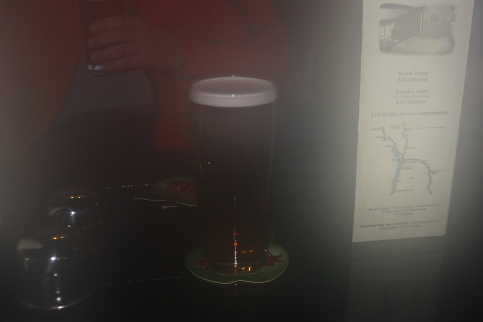
Journey's end and a quick change out of our fell clothing at the car, followed by a short car journey to Ennerdale Bridge and The Fox and Hounds. This is another gem of this valley with a variety of beers, mainly local with an added twist of travel miles marked on the pumps. Some of the beers were from Ennerdale brewery, 2.3travel miles away, even the Loweswater Gold was 35travel miles, though it is no longer produced at Loweswater in the next valley. Either way the Ennerdale Gold and the Loweswater Gold couldn't be faulted. With a good roaring fire and quality beers to warm up three retired(old) men it was a perfect end to a cold 12.5km, 850m ascent, brilliant short day's walking.


Saturday 26 January 2013

Five Loweswater Wainwrights and an iconic pub.

Thursday 24th January saw three of us set out for a walk in the Loweswater range, to take in the fells of Burnbank, Blake, Gavel, Hen Comb and finally Melbreak. Well, I say finally as the last destination was to be The Kirkstyle Inn of course. The weather forecast was given as overcast though the journey down from Carlisle looked as if it would be better than this and when we set off from Maggie's Bridge (NY135210) the sky couldn't have looked more promising. The White fells were all around us, with a glorious blue sky backdrop as we headed along the Watergate Farm track which skirts Loweswater.

 
Loweswater looking north from Watergate Farm track.

 
Striding out for Holme Wood, Burnbank our first fell in the background.

Although this looks cold there was little wind and the temperature was reasonable throughout the day so it was actually a pleasant walk. We were soon to pass the farm and turn left once through the gate heading through Holme Wood. Our only real obstacle here was a blown down tree blocking the path, which had not been there on two previous walks this year.

 
Holme Wood track slanting through to Holme Beck.
 
We pressed on here, the chest exertions deepening but once through the wood there is a slight pause before the next uphill drive. Once over Holme Beck a track goes off to the left and we headed along this until we came to the fence that goes directly up. We donned the trail spikes to give some purchase in the slippery ground under the soft downy snow. This gave us a breather before the fence trail, a real Achilles stretcher. You can only get your head down and drive on here, the near top eventually comes as the incline perceptibly lessens. You can turn to take in the view of the Mosser range of Low Fell and Fellbarrow, the lake beneath and view toward Grasmoor. Here we went over the fence and followed the peaty path for Burnbank summit.

 
The hard climb over, walking to Burnbank summit.

 It is an unremarkable summit yet as with the Mosser range, you get clear views of the Solway Plain, Robin Rigg windfarm(60) in the Solway Firth and on clearer less hazy days, of Scotland and The Isle of Man. A turn to the left and it was now a drop then shallower climb in iced peat to the cairn that is Blake Fell and the highest point of the walk at 573m. The views all around are wonderful but these fells, with the exception of Melbreak are peat paths in nature and if you are looking for a crag type scramble these first four do not fit the bill. They may also not be the biggest Wainwrights, but you have had a walk by the time you get to the end of this route. A gem of this fell is to move slightly to the west and take in the view of Congra Moss and Knock Murton Fell.

 
A frozen Congra Moss and Knock Murton Fell.
 
Time now to push on for Gavel Fell and then change direction for Hen Comb. Gavel again is a rounded fell with little to remember it by other than the views of the Buttermere range. It is always educational to see the lakes and fells from different angles and a walk on these if for nothing else, gives you this. As we passed Gavel's summit we were thinking of when to take our food stop and decided on Hen Comb summit, or nearby. We dropped off and followed the fence line through Whiteoak Moss. This is normally boggy, but the iced conditions made it good to walk in; other times I've had boots full of peat water here. I suddenly saw the sun on the grass tufts, nothing in spring or summer, but the contrast of hay and snow in low sun just made them magically jump out of the landscape.

 
Whiteoak Moss, heading now for Hen Comb, Buttermere valley opening.
 
To follow this fence it finishes then abruptly, but just carry on directly up and you meet a path coming from Floutern Cop/ Great Borne direction and it lessens in incline to a gentle walk to the top. We took in the views here and as last time, headed to the saddle of Melbreak, though had our food & hot drink before we dropped off Hen Comb for the Mosedale Beck crossing.

 
Melbreak with Grasmoor behind, seen from Hen Comb.

 Once the food was in us we headed down and found the beck less of a challenge than our last outing where another colleague had ended up in the beck and not over it These are the challenges we take on, you can laugh about them months later, but they're not funny at the time. We pressed on for the saddle but it was here I was beginning to feel it in my legs; still the last real climb so it was a 'grit of the teeth' and a push for the top. Thankfully we made the saddle and the summit was to our far right. We knew this but it means we needed to then come back on ourselves. We took in the magnificent views of the Buttermere ranges from the summit though.

 
Looking back on Hen Comb from Melbreak's saddle.

 
Melbreak Summit, looking deep down Buttermere Valley, Fleetwith Pike in the far centre.

 
Left to right, Whiteside, Grasmoor and Whiteless Pike, taken from Melbreak.

Now the pub thankfully beckons and we retraced our steps and onto the more northern and 3m lower peak of Melbreak. Here once again the Solway Plain vistas opened but were overshadowed by the distant sight of The Kirkstyle Inn. We felt like the three wise men must have as Bethlehem came into view, as I'm sure there was a halo around the pub.

 
'Heaven' to the back right corner of the wood.

This had been an easy underfoot walk even in snow, but newcomers to it need to be aware here of a steep rocky and scree descent to Loweswater. In ice you get close to steep edges or can slip and keep sliding. Take time on this way down. If you drive down the Lorton Valley to do this walk, look at the right face of Melbreak, it is steep and that is where you will come down on this route, though there are lesser ways off..
 Soon we were on the valley floor and walking toward the hamlet of Loweswater with it's pub and church. You can't avoid the purgatory of having to walk past The Kirkstyle Inn in order to get back to the car. Somehow we resisted and made the car. A 5hr walk of 17kms with 1150m ascent in powdery snow. A short hop in the car and three pints of Cumbrian Legendary Ales Pacific Voyage (Fletcher Christian is an infamous son of Cumberland and you look toward his old farm near Cockermouth) one each; the beer is served in rare to see measured pint glasses, absolute nectar of the Gods. This was washed down with an every bit as good, pint of Loweswater Gold and off we headed home. A days exercise and social meeting complete, nothing better.

Thursday 24 January 2013

Snow, a cave, three Wainwrights & two Patterdale pubs.

17th January saw four of us set off toward Ullswater with an intent to walk but the route not yet defined. We travelled down the length of the lake and as two of the group had not been to Priests Hole, we settled on Cow Bridge car park as our commencement point for the walk. Priests Hole was an admirable goal, though The Kirkstone Pass Inn and The Brotherswater Inn were also high players in why we chose a route up to Dove Crag before turning left for Kirkstone via Red Screes.
 The weather looked reasonably clear without rain and perhaps some thin snow, the valley bottoms were clear yet one didn't need to look too high before the snow line started. We set off along Brotherswater, passing Hartsop Hall en route for the lower path of  Dovedale. In the snow this is tricky to keep to and the higher path following the wall line I had previously found much easier.

 
Passing Hartsop Hall, the view to High Hartsop Dodd.

 
Looking to Dove Crag with Priests Hole in view.


 We reached the bridge over Dovedale Beck and crossed here and after a little while the path steepened and there was a need within the group to alter the clothing layers. This becomes a steep fix the fells route to Houndshope Cove and whatever the speed you walk you will feel this in your legs. It is also a good route to take regular breathers and turn to admire the view of Patterdale from here.

 
Dove Crag and Priests Hole in cloud.

 
Looking back into Hartsop, from the Houndshope Cove ascent route.

We had donned our trail spikes here, for ice as well as snow covered the steps of this route. After a hard push up we reached the erratic stone that denotes the turn for Priests Hole.

 
Houndshope Cove erratic, looking back to the High Street range.
 
There is just something about this erratic stone, out of place in the landscape yet occupying it for many thousands of years. I always take the time to take in the view from here. We turned and the route to the cave was relatively uneventful bearing in mind the ice and snow. Having been up to it a number of times I am well versed in the with the track when covered in snow, though the ice axe was also 'at the ready'.
 
 
Priests Hole, looking across Hartsop above How.
 
No one was occupying this and we had a small break for a coffee and a sandwich here, before pressing on for Dove Crag. As we reached the ridge of the range the icy wind hit us with no protection from the fell, though thankfully the temperature was not too low to really freeze the bones. Our intention was to get to Little Hart Crag and then Red Screes before a decision on whether we had time to continue past Kirkstone Pass Inn for Caudale Moor.

 
Pressing on for Dove Crag.

 
Checking on the time, a decision to be made soon.
 
 At the Hause of Scandale Pass we came across a group of eight who had set off from Cow Bridge at much the same time as we had though they had taken a different route. It was here that one of the group recognised Holly 'The Beast' and I was pleasantly surprised to meet a person I had met on an earlier group walk on Skiddaw. These surprises help make a day memorable. Nice to see you there Ria. Part way up to Red Screes we polished off the rest of our bait, sheltering behind the wall.
 After Red Screes it was obvious that the snow was slowing our normal pace and one of our group had not been out for a couple of months. To have continued on after The Kirkstone Pass Inn would have been foolish, so the decision was made to head for the car after Kirkstone Pass.

 
Descending Red Screes, the pub just coming into heavenly view.
 
This steep descent was tricky in ice, though we made it down. The benefit of calling an end to the fell tops was that we could indulge in two pints here and not just the one, which we duly did.


A misted lens view of the first pint.
 
We still had the pass to descend and although I have never been on it I was aware of a permitted path on the north side of the road, still a suitable distance from the road itself to let the dog off the lead for the most part. This descent had the added benefit of taking us past The Kirk Stone, after which the pass takes it's name.
 
 
The Kirk Stone.
 
This was a steady descent, uneventful except for the views of the valley. We passed over a bridge and joined the Scandale Pass path at the valley bottom, passing through the ancient settlement marked on the ordnance survey map. We once again passed Hartsop Hall and were back at the car park of Cow Bridge.
 
 
View back up the valley from Cow Bridge car park.
 
Well, a good walk and after one further pint at Brotherswater Inn the day was complete a good socialising walk with friends, 17.5kms with 1100m ascent in six hours, a decent walk out in snowy conditions.


Tuesday 15 January 2013

Buttermere valley walk, The scecret Valley and battle.

Saturday 12th January 2013 was a day for a leisurely walk in The Lakes, a family day with my wife and it was never going to be a high fell walk. At the point of climbing into the car with the sandwiches and dog now stowed, a final decision was made to head for Buttermere and a stroll around the lake. It's a decent 7.2km walk in stunning countryside and although the snow had receded to nothing and the day a little overcast and cold, I was rightly confident of the weather holding out so it should be a good easy fulfilling day. We parked on the Newlands Road above the church and walked down to the lake passing as always, The Bridge Hotel and The Fish Hotel.

 
The Bridge Hotel, Buttermere.
 
From here it's a path to the left after The Fish Hotel, tracking toward Buttermere itself, heading to Burtness Wood on the side of High Stile. I took the time here to divert to the lake shore as this gives the classic shot of Fleetwith Pike, view of many a photograph and painting, in the right weather this is an iconic image on a par with Ashness Bridge and Skiddaw.

 
Fleetwith Pike from the Lakeside path

 
Fleetwith Pike with Burtness wood on the right, Robinson to the left.
 
By this time The Beast( or Hollydog to my grandson) is loose and has already been in Buttermere Dubs at the bridge crossing. The joy of any walk is as much to see a thing you love having the time of it's life, but diving into a stream on a cold winters day doesn't float my boat.

 
'I'm a tad wet and couldn't find the stick''
 
The walk continues along the base of High Stile and the views across the lake are to the Robinson range and Dalegarth. There is an excellent steep ascent(Hassnesshow Beck) onto Robinson from Dalegarth that misses out Buttermere moss, a place to be avoided in the wettest season on record. Take my word for it, people always seem to go on this route for Robinson as it is the one from the car park, but you get two boots full of peat water.
 Looking back on a walk is every bit as interesting as the view forward and to turn here you get the full view of the Grasmoor range with Whiteless Pike, Grasmoor, Crag Hill and Rannerdale Knotts in view.

 
Looking back on Grasmoor
 
This range along with Buttermere valley really does have it's place in the history of England and from what I've managed to read was a sore in the side of the Normans, being the last place in What is called England to be captured by them. Earl(Norse Yarl, meaning Warrior King) Boethar (giving the area the name Boetharmere) had turned the valley into a fortress and following one massacre of the Normans in Newlands valley a later attempt was made from Cockermouth. The road into Buttermere ran over the shoulder between Hause Point and Rannerdale Knotts but this was hidden by Boethar and another 'road made up the Squat Beck valley. To anyone that knows this route it is perfect ambush country and the Normans were drawn in, cut off from behind and annihilated. King Stephen ceded the land to Scotland through his reign. From what I have read even phrases within our language come from this area. Ari Knudson even ventured as far as Alston and Brough (toward Scotch Corner on A1) and was a constant wound in the Normans side, hence the expression 'Fighting like old Harry'. We walk an area not really realising what we walk on or through but we walk through history.

 The path continues on to the end of the lake at the beginning of Scarth Gap Pass where we stopped and had our sandwiches (your 'bait' in Cumbria). You can take in the deep valley head here with Robinson, Dale Head, Fleetwith Pike, Haystacks and the High Stile range virtually closing you in on three sides and understand in a fertile valley, in the days of woods and bows, why this would be a perfect place of defence. We moved on toward Gatesgarth Farm and the Cockermouth mountain rescue cabin, passing over Peggy's Bridge at Warnscale Beck and an opportunity to look right out of the valley from the top of it's pasture.

 
Warnscale Beck and Buttermere.

 
Left to right, Fleetwith Pike, Green Crag and Haystacks.

 
Buttermere with Melbreak beyond.

To move to the road side of the Lake or Mere you now get the view of your previous track below High Stile. Looking to this fell, most take in the full ridge from Red Pike, but there is in my view the best, yet little walked route to the summit of High Stile passing to the right of Burtness Comb.

 
Left to right, High Crag, Burtness Comb and High Stile. (You can just make the peak of Red Crag to the far right)
 
I love trees and how they find an existence in difficult terrain. This one always captivates me as it grips the rock clawing deep for hold as much as for nutrients, to continue it's existence. I'll have to go up to it one day as I think it will be a Yew, though that will need closer checking. It makes my day to see something like this, making it go beyond just a lake or mountain walk.

 
Hassness and Crag Wood, tree clinging on

 
Same tree but looking back to Haystacks.
 
We are now three quarters way around the walk and after a a short while we will come across the tunnel section through the crag at Dalegarth. This is believed to have been carved by the employee of George Benson, a mill owner. when he built the original Hassness House. The house has always looked odd on the landscape and views of the original one seem to have been more in keeping with the areas beauty.

 
Tree root exposed by countless footfall.
 
 
If she's anything, she's inquisitive.

 
The tunnel.

 
Looking back.
 
This tunnel ( I assume put there by The Victorians) makes a full leisurely lake walk possible without recourse to scrambling over crag, or a long road section. It marks the near end of the walk but a last opportunity to encourage The Beast to take a bath with a big stick throw.

 
Buttermere, a wet dog and High Crag.
 
 
Journey's end(Buttermere) and Melbreak beyond.
 
This takes you through the farm and you come out at The Bridge Hotel. A short walk, not up a mountain, but among them. If you're in The Lakes and don't fancy a fell top, try this, you'll enjoy it.