When I initially started this blog I stated my former occupation as the control room inspector (now retired) at Cumbria police headquarters. I hope here to improve walkers knowledge of an incident through this experience and my frequent walks in the fells. Some processes have evolved since my leaving and I have tried to keep myself updated on what those are and how they impact on safety on the fells. My specific experience is within Cumbria, The Lake District, though many of the issues I discuss are relevant to other mountainous areas, though the protocols may vary. I have no intention here of giving you guidance on what to take and how to conduct yourself on the fells, the mountain rescue teams make strenuous efforts in this regard through their internet sites and displays at annual shows, etc. and it is not my area of knowledge beyond what an experienced walker already knows. It has been said often enough that you should be adequately clothed for the expected conditions, carry and know how to use a map and compass and any other navigation aid is a suplement to these 'must haves'.
I'll put down a marker here by stating I hold the volunteers of the mountain rescue service in the highest regard, through their expertise, commitment and bravery.
Let us start firstly with an incident which occurs on the cumbrian fells that you are either involved in or have come across. You ring for the mountain rescue and if you think you are going to get the mountain rescue on that initial call, then this has potential for going seriously adrift immediately. The initial 999 call goes to BT who will ask you 'which service do you require?' and your reply is 'Mountain Rescue'. Remember the M.R. teams are all volunteers and have to earn their own living. You will get the police communications centre who will record the information you give and through a system will pass this to the M.R. team for that area. Where incidents go wrong is the information may be imprecise and it is not given to a person (the operator) who knows the fells intimately, if at all. That operator may never have been on a fell in their life or have any sense of where that is. It is worth noting that mountain rescue incidents probably account for a quarter of one per cent of all calls to the police control room and an operator cannot be expected to be versed in every specialist area. They will take the information you give also asking questions, record it, and pass it on to the mountain rescue team. If you say Eagle Crag to an operator, you are probably describing the Wainwright at Stonethwaite but I know of three other such named crags and know of one incident where the wrong MRT was being called out due to this simple error of location. There are two Seathwaites, two Harter Fells, two Gris(z)edale Pikes, White Side & Whiteside, before we even begin to move on to tarns or forests, Gills, becks of the same name. Difficult as it is a caller must remain calm, you will be asked a series of questions and these have a purpose so answer them, no matter how drawn you are to a casualty. Map references are excellent especially these days with navigation devices or applications on smart mobiles that give you just this, your phone signal itself will not give it, you will need to pass this to the police operator. There are routes I have walked hundreds of times but I still take a GPS so if injured I can give an exact reference for the team or heli. Many mountain leaders will state you should know where you are off a map at all times. This would be utopia but the reality is to deploy an air resource, the six figure map reference is a godsend to the MRT and heli. Many people think they know where they are but have gone off course by 180 degrees. One incident was a full team of six men who walked a Bowfell horseshoe from Langdale and ended up in Boot. So :-
a) State where you are, ie., Scafell Pike
b) Give a six figure map reference(bigger may add to the operators confusion and is too accurate) stating whether from a GPS or worked out from map.
c) State how serious the casualty (it will affect the resource deployment)
d) State where you set off from, ie., Seathwaite, Borrowdale.
e) State by what route you ascended, ie, Corridor route or Grains Gill.
f) Go on to state appropriate clothing & food
g) Don't move from that location.
Regarding g) one mountain rescue team spent all night trying to locate a lost individual who walked and walked. The MRT were checking locations and he wasn't there, but later he was, though the MRT weren't. They finally stumbled upon him in Glenderamackin valley, where he had originally got lost(and still was).
At c) above, don't centre on this. If the mobile signal is lost then knowing we have a serious casualty somewhere in the lake district means nothing without knowing where and you would be suprised at how many calls are suddenly lost. When police officers are being assaulted they are trained to give three things, location, location, location. The police know there is a problem that's why you're on the 999 call, they want to know where you are ( and spell it).
The police pass this information immediately to the MRT who are the experts on every nook and cranny on their patch. On virtually every mountain rescue they will want to contact you to clear any confusion with the original police contact, so leave someone with the mobile at that location if you can. If everyone drops off the fell to assist the injured party the signal may well be lost for recontacting you. You have not helped the injured party by doing this, though I understand the dilemma if you are the only other person.
If no recontact has been made after 15minutes then recontact the police control via the 999, believe me when I say something needs clarification, it nearly always does. This is still an emergency so if you cannot get through on the new 101(non emergency) then a second 999 is the appropriate contact method. You are in a mountainous area and will be lucky to get a signal on your own network. The way the 999 system works is where it cannot locate to your service providers network, it will use any network to put in the call. It is vitally important that this point is made because it needs to be understood that when the MRT or police try to recontact you, it can only be via your service providers network and we've already covered that this may not be possible, so without another call you and/or the casualty may be in serious danger through an unnecessary delay. After your first call the MRT have been contacted, if they cannot contact you and you later ring by 101 or 999 the police should be able to transfer this 'live' call to the MRT base station they have by now attended; this was what you had really wanted. On 999 calls the number calling is automatically recorded. If you can, give them every mobile number in the group, particularly on different networks, even if there are six mobiles.
You will reach a point where you are satisfied the MRT are en route and now it's merely a question of waiting, so be patient. Different incidents will have different attendance times but the team have to get to base, get changed, travel to the area where they deploy out of the vehicle and get up to the incident. It amazes me at the speed they respond, but to you it may seem an age. Remain calm, they are bending their will and physical limits to get to you. I could go into accounts where this team of volunteers has only been met with verbal aggression at a response time, but I am sure you can imagine the scene.
Other areas that require knowledge would include air resource deployment and what is given from a mobile emergency contact regarding your position but there's enough to digest for the moment here.
Enjoy the great outdoors, dress appropriately, act responsibly and keep safe. Never forget the MRT charity box in the pub. If you can afford a pint, you can afford a donation for these selfless individuals, it's ultimately for your rescue when all is said and done.
Friday, 11 January 2013

Thursday, 10 January 2013
Bowfell from Langdale and a Cloud Inversion
I had been watching the local weather forecasts for a few days and Wednesday 9th January was looking like it was going to be a good day. That was a stroke of luck as the last three walks this week had been in poor conditions and we were due a clear walk after this summer and autumn. This was a planned day out and not seized upon for the weather so we were to take what was thrown at us. We set off from outside Carlisle at 08.15hrs and headed over from Grasmere where inversions were present from Dunmail Raise. Unfortunately I was unable to stop, but it was breathtaking. We headed over toward Stile End and pulled over for a photo shot at Walthwaite, above Elterwater.


A distant view of The Langdales, the inversion in sight.

Conditions were clear at Old Dungeon Gill. This changed as the day progressed.
We continued on, stopping briefly at The Old Dungeon Gill but decided to head toward Blea Tarn to see if we could park the car free of charge. After some 'toing and froing' we finally parked on the roadside. There was a hint of a brocken Spectre halo as the sun shone over the hause from Blea Tarn but by the time we got kitted any opportunity for this had gone. It was 10.10hrs before we finally got moving and our intention was to go right round to Pike of Stickle, but this proved too optimistic in the end. The inversion deepened and the valley looked heavenly.

Looking to Crinkle Crags, Bowfell & Hell Gill

The Langdale Pikes and Rossett Pike in the distance.
We headed up Rakerigg, just skirting Wrynose Fell summit and making our way to Pike O Bliscoe. It was here that we began to get onto frost and ice. It was well worth it for the views from this fell.

Looking back from Pike O Bliscoe to Lingmoor with it's offshooot that is Side Pike.
Once on the summit, both cairns were very slippery underfoot and the 'fix the fells' paths were lethal to descend on. We made Red Tarn without any major mishap and began to press on upward for Crinkle Crags. This path is loose stone and shallow incline, relatively speaking so we got our heads down and pushed on quickly, stopping occasionally to take in the southern views to Coniston Old Man. Being in the line of the sun, I took no photos of this group, but it looked lovely.

Pressing on for Crinkle Crags after Red Tarn.

The view back to Pike O Bliscoe

The Scafell Range coming into view

Harter Fell(Dunnerdale), peeping through the inversion.
The approach to Crinkle Crags opens up Dunnerdale and Eskdale, with the Scafell Massif opening up as you look out into the direction of The Irish Sea and the mist appeared much deeper here as it rolled in. Once over the first rock outcrop we were then onto The Bad Step path. There is an alternative to this which goes to the left of the rock face that confronts you, but we always take the Step route.

The Bad Step on Crinkle Crags.
One can climb onto the rock overhang but the best route is just above where my dog Holly(The Beast) is. It's a scramble but relatively safe in good weather. Once up here you are then walking to the highest summit cairn on this 'fell of a few tops'. Be careful on this mountain, in poor conditions with cairns all over you can lose the path and what is safe in good visibility can be dangerous if lost in cloud. A tragic incident occurred on 5th of this month (4 days ago) where a walker fell to his death in cloud. Take your time in orientating yourself here.
We pushed on past Crinkle Crags and our next destination and highest point of the walk was to be Bowfell. It's another 200m ascent from The Three Tarns Hause and we had only had a kitkat by this time. The frost and ice was thick as we walked now in shelter of the sun and I took a tumble taking the shock on my shoulder. I felt some fibres twang but luckily nothing broken or dislocated, it's a risk of the adventure one has to accept. We continued on though I could feel the fatigue of lack of food, but after half an hour we were on the summit with 360degrees views of the inversion and it was stunning.

Bowfell Bait stop, looking to Lingmoor Fell.
With a later than expected start with care having to be taken to allow some safety margin in case anything goes wrong, we decided to head off the fell. We chose to head for Angle Tarn from the Ore Gap route to extend the walk so we covered distance but get low early enough. We had considered The Band route, but that would have been too short for the distance we had journeyed. While heading toward Ore Gap a Seaking heli was over Scafell and lowered to it's summit or Lords Rake, the scene of a fatality a month ago. I hope it was a training exercise, though I didn't think it looked like that. Once at Angle Tarn we headed down Rossett Gill, missing Rossett Pike and Pike of Stickle as we had earlier decided. We ate the ground up on this descent and were quickly on the line of the inversion.

Angle Tarn and Bowfell

Coming to the inversion line, Langdale Pikes on the left, Lingmoor to the right.

Pike of Stickle

Beginning to be enveloped.

Now just in the mist looking up to Bowfell and Crinkle Crags.
Once in the valley bottom it is a long valley haul back to Old Dungeon Gill and then we had a road walk to reach the car. You get no traffic noise in this valley which is a big bonus, just the local Herdwicks to wonder at your passing.

Tough Herdwicks, they can get anywhere and live off anything to survive, originally of Viking origin I believe.

A final picture to show the contrast in conditions from the walks start to it's end, at The Old Dungeon Gill
Well, that was 18km, 1250m ascent of a day spent in heaven. We just managed to keep it within our 3km/hr rate, which was good bearing in mind the rugged terrain and iced rocks. Now time for a couple of pints and for the first time we went into Wainwrights Inn at Stile End. I've always went past this heading instead for The Britannia at Elterwater. I thought it might be a bit of a theme bar to Wainwright the man, which never appeals to me but I was wrong, the six cask beers looked good and the two I had were certainly were well kept. I'll stop off here again, though it was a little dark and broody inside, but that is it's nature.
Now time to head home and having told my wife not to make any dinner as I expected to be well late, I geared myself up to a fried egg butty or beans on toast, but no! A Mediterranean style casseroled chicken dish was just being finalised as I gave the dog it's shower(the outside hosepipe) and the day was rounded off perfectly. Oh bliss.
Tuesday, 11 December 2012
High Stile Range, a risky day to learn a lesson from.
Monday 10th December was looking good for that month, with a clear sunny day as a forecast and it wasn't to disappoint. We set off from Carlisle at 08.40hrs, just Holly in the cage as Dylan was favouring his chest and not at his best. Dylan wasn't the only one under the weather as I was on antibiotics for a chest infection. He had more sense stopping at home, but it had been a week since my last walk and I was going to seed.
You get a good view of the northern fells as you travel A595 for Cockermouth, with Grasmoor looking majestic with it's crown of snow and Butteremere Valley opening to view. We missed out Cockermouth, morning rush and Christmas choking this small town and took the Paddle School shortcut for Lorton and on to Buttermere, parking above the church.

We were the first to park, though I was surprised at this on such a clear day. We set off, passing The Bridge Hotel and The Fish and heading for Old Burtness and the fix the fells path to Bleaberry Tarn. No matter how intent you are on a specific goal, one can never fail to be in awe at the majesty of the views in such clear weather, with the thin snow providing a magical contrast.

This is such a beautiful valley, time has to be taken to soak up nature and these kept improving the higher you climbed up to Bleaberry Tarn. Photo stops helped to slow our ascent though we still managed to move quickly to get the heart racing and the legs aching (and the chest heaving).


As we came toward Bleaberry this normally signals a rest break to take in the view of this lovely tarn. I've taken many pictures of this and also the view behind of Newlands valley but it suddenly struck me to take one from the corrie side of the tarn with it and the fells combined in one shot. This was at one and the same time, a touch of brilliance and the beginning of a stupid act. We moved round the tarn and set up for the photo.

I was chuffed with this view as it's not one often seen, if at all. We then turned, looked up, nothing looked too daunting, so we set off up the corrie, avoiding the longer walk to the path up The Saddle.

This was our mistake, as we had only micro spikes and no ice axe. The snow was soft and for two thirds of the way we were untroubled, but for the last third the snow increased and became much harder. Lets say we got up ok without incident, but I learnt a lesson that day. I'm a walker not a climber and was relieved to get to the top. While on this ascent I saw the Seaking pass toward Wasdale and that was an incident of tragic consequences. Still, we were now on the wide ridge and time to move on, heading for High Stile. We passed the summit cairn, taking care all along this route as the normal path passes snow encrusted corries and we weren't looking for that quick a descent.

I stopped a moment for another photo of Grasmoor though with mans influence on the fell top to add interest as in this shot above. It was approaching bait time, though there were at times a strong wind which chilled the bones so we decided to drop off High Crag and bait near Seat. Anyone who knows this area is aware of a steep descent off Gamlin End. It's a fix the fells path, but even that is chocked up with falling scree. For an acknowledged path it was virtually an ice axe descent(if I had took one), though we got down through digging into the softening snow, Steve switching to a safer scree descent for traction. At the bottom we met a man and a woman in there late sixties/early seventies who between them had a pole each. After asking us for advice and being informed they would come to grief if they continued, they then proceeded to take no heed and set off up High Crag. We sat eating our bait and watched this play unfold. They were doing ok but started hunting for a better route, split up drifting a considerable distance apart, started slipping down, had a debate where I believe sense prevailed and returned before things got worse. I could criticise, but not after our earlier error, so we said, "Good decision" as they passed us by.

We cracked on over Seat, passing them once again and at Scarth Gap took the Buttermere route for the lake. This was uneventful though the views were again wonderful but in a different light. Apart from some cloud for a few minutes on High Stile the views were uninterrupted.


You get a good view of the northern fells as you travel A595 for Cockermouth, with Grasmoor looking majestic with it's crown of snow and Butteremere Valley opening to view. We missed out Cockermouth, morning rush and Christmas choking this small town and took the Paddle School shortcut for Lorton and on to Buttermere, parking above the church.

A much photographed view, but I make no apologises.
We were the first to park, though I was surprised at this on such a clear day. We set off, passing The Bridge Hotel and The Fish and heading for Old Burtness and the fix the fells path to Bleaberry Tarn. No matter how intent you are on a specific goal, one can never fail to be in awe at the majesty of the views in such clear weather, with the thin snow providing a magical contrast.

Who could pass without stopping to take in this iconic view of Buttermere and Fleetwith Pike?
This is such a beautiful valley, time has to be taken to soak up nature and these kept improving the higher you climbed up to Bleaberry Tarn. Photo stops helped to slow our ascent though we still managed to move quickly to get the heart racing and the legs aching (and the chest heaving).

Buttermere with Grasmoor range as it's backdrop, capped in snow

Looking to Crummock with the Mosser(pronounced Mozzer) range directing the eye to Scotland.

Buttermere and Fleetwith Pike, Honister pass to it's left.

Coming up to the corrie, Bleaberry Tarn about to come into view.
As we came toward Bleaberry this normally signals a rest break to take in the view of this lovely tarn. I've taken many pictures of this and also the view behind of Newlands valley but it suddenly struck me to take one from the corrie side of the tarn with it and the fells combined in one shot. This was at one and the same time, a touch of brilliance and the beginning of a stupid act. We moved round the tarn and set up for the photo.

Bleaberry Tarn with Crag Hill and Lad Hows off Grasmoor.
I was chuffed with this view as it's not one often seen, if at all. We then turned, looked up, nothing looked too daunting, so we set off up the corrie, avoiding the longer walk to the path up The Saddle.

Another view of Bleaberry with Crag Hill and now Robinson framing Newlands.
This was our mistake, as we had only micro spikes and no ice axe. The snow was soft and for two thirds of the way we were untroubled, but for the last third the snow increased and became much harder. Lets say we got up ok without incident, but I learnt a lesson that day. I'm a walker not a climber and was relieved to get to the top. While on this ascent I saw the Seaking pass toward Wasdale and that was an incident of tragic consequences. Still, we were now on the wide ridge and time to move on, heading for High Stile. We passed the summit cairn, taking care all along this route as the normal path passes snow encrusted corries and we weren't looking for that quick a descent.

Grasmoor from High Stile with a boundary fence post marking Allerdale(Buttermere) and Copeland(Ennerdale) District boundary.
I stopped a moment for another photo of Grasmoor though with mans influence on the fell top to add interest as in this shot above. It was approaching bait time, though there were at times a strong wind which chilled the bones so we decided to drop off High Crag and bait near Seat. Anyone who knows this area is aware of a steep descent off Gamlin End. It's a fix the fells path, but even that is chocked up with falling scree. For an acknowledged path it was virtually an ice axe descent(if I had took one), though we got down through digging into the softening snow, Steve switching to a safer scree descent for traction. At the bottom we met a man and a woman in there late sixties/early seventies who between them had a pole each. After asking us for advice and being informed they would come to grief if they continued, they then proceeded to take no heed and set off up High Crag. We sat eating our bait and watched this play unfold. They were doing ok but started hunting for a better route, split up drifting a considerable distance apart, started slipping down, had a debate where I believe sense prevailed and returned before things got worse. I could criticise, but not after our earlier error, so we said, "Good decision" as they passed us by.

Gamlin End route to High Crag, the two can be seen under the zigzag.
We cracked on over Seat, passing them once again and at Scarth Gap took the Buttermere route for the lake. This was uneventful though the views were again wonderful but in a different light. Apart from some cloud for a few minutes on High Stile the views were uninterrupted.

Haystacks from Scarth Gap Pass

Buttermere with Rannerdale Knotts in sunlight.

All I said was 'Swim!'
Once off the fell and into the valley it was a lake walk back to the car. That was it, a 12.5km, 950m ascent walk which should have been uneventful, but wasn't. Two wiser men climbed into the car and we set off for The Kirkstyle Inn.

Now as a pub with a backdrop this one takes some beating. With a roaring fire, top quality beer served in pint measured glasses, what better way to end a days walk could there be?
Saturday, 8 December 2012
Scafell Pike, again but not the same.
I would normally put up a blog only if I take out my camera and this I take only in decent weather. I explain this to justify the lack of blogs of late as I have been out in some awful conditions, both underfoot and under the heavens. One walk I completed with my walking companion Steve, was on 27th November 2012. Where did we go? well we've had enough of walking through bog this season to last a lifetime and a walk to Scafell Pike can never be said to be a boggy route. The stipulation for this walk was crag not clag(underfoot) so off we headed for Seathwaite, again. I had the camera with me though when we arrived at the farm the cloud was brooding. It didn't bode well, though off we set with our trusty hounds underfoot, Dillon in his normal measured manner and Holly(the Beast) like a missile.


Ours was the third car parked at the farm and it seemed to suggest others had thought better of venturing out onto the fells that day. One group of four men were setting off for The Pike and after advising them on the Grains Gill path we left them to it. We headed for The Corridor Route as it was my intention to take Steve to The Pike via the Dropping Crag route between Scafell Pike and Broad Crags. Most of this walk he has done before but this was a new, though short section he had never been on.
The weather was never wonderful as we headed for Styhead Tarn, the rain and increasing wind as we became more exposed to The Wasdale Valley and it's funnelling qualities off the Irish Sea and beyond that, the Atlantic Ocean. In the main, the summits were lost to our view but this is a route completely committed to memory and it needed to be as we found later on the top. The walk was uneventful in it's steady climb, the only part I took an interest in was as we crossed Skew Gill on the north face of Great End; this is a route onto this fell I have not climbed and intend to this year. As we got to the outcrop that is Stand Crag, a scramble that puts nervous walkers off this route, we hit the snow line at 600m that marked a change in conditions for this walk. We climbed down this and continued on in encrusted snow that never took your weight and ruined your stride by constantly giving as you bore on it with your full weight. The higher we got the deeper this snow was, but still below the boot line. With Criscliffe Knotts and Middleboot Knotts to the right there is a 'fix the fells path denoted to the left which branches off The Corridor and this was to be our route for the summit. It's a strange path this as it is clearly 'fix the fells' but a little higher it just disappears, though if you keep Broad Crags to your left you can't really go wrong and you will also be following the Gill upward; this eventually drops behind you into Piers Gill. Forgive me for no photos here as I was trying my damnedest to wade through thigh high virgin snow. I say virgin though one had been up before me and that was Steve. When he's on a mission there's nothing holds him back and I was trying to keep him in sight here. This was short, but that gives no testament to the work involved getting through this thick duvet of Christmas covering. Finally and thankfully, we came to the Hause between Broad Crags and Scafell Pike. The final section is the steepest, but with the top in sight who cares? As Steve had time on his hands waiting for me he had altered his clothing for the final thrust to the top, but I needed time to don more layers and change gloves. This is hard when you can't feel your finger ends and Steve had to crack on to keep himself warm.


 So here we were, now time to look for a good sheltered part to eat our bait. No such luck, it was a question of what was the best bad place in the wind and to clear as much snow as possible and hope it doesn't leak through your trouser seat. I have one sop to age and that is a folding cushioned mat, a godsend at a time like this and I used it.
While taking a short bait we were suddenly joined by a lone hiker who had come from Wasdale, this being the only person we had seen to date. The four men who set off from Seathwaite we knew we would be in front of and to be honest we expected them to turn back in these conditions. This walker was completing his Wainwright round and was well attired for the conditions though I would have advised a walking buddy on such a day. He was moving on to Scafell via Foxes Tarn and after advice on his route we left him after we sorted out our layers for the route off.
 We were going to head for Lingmell coll and the Corridor again though in snow this took some effort. Even on a well remembered route snow can have such a disorientating affect, though we hit the big cairn spot on and followed this line down. Once at Piers Gill it was merely a question of staying on the Corridor to Styhead. Our intention had been to carry on up to Great Gable but time had not been our friend so we just headed back to Stockley Bridge, the car and The Scafell Hotel at Rossthwaite. Two beautiful beers and the day was complete. Oh, the four men? their car had already gone, someone had sense that day, but at least we 'earned' our beer.

Sourmilk Gill at Seathwaite.

Seathwaite Farm, you can just see the plaque on the left of the gate, stating it is the wettest place in England.
Ours was the third car parked at the farm and it seemed to suggest others had thought better of venturing out onto the fells that day. One group of four men were setting off for The Pike and after advising them on the Grains Gill path we left them to it. We headed for The Corridor Route as it was my intention to take Steve to The Pike via the Dropping Crag route between Scafell Pike and Broad Crags. Most of this walk he has done before but this was a new, though short section he had never been on.
The weather was never wonderful as we headed for Styhead Tarn, the rain and increasing wind as we became more exposed to The Wasdale Valley and it's funnelling qualities off the Irish Sea and beyond that, the Atlantic Ocean. In the main, the summits were lost to our view but this is a route completely committed to memory and it needed to be as we found later on the top. The walk was uneventful in it's steady climb, the only part I took an interest in was as we crossed Skew Gill on the north face of Great End; this is a route onto this fell I have not climbed and intend to this year. As we got to the outcrop that is Stand Crag, a scramble that puts nervous walkers off this route, we hit the snow line at 600m that marked a change in conditions for this walk. We climbed down this and continued on in encrusted snow that never took your weight and ruined your stride by constantly giving as you bore on it with your full weight. The higher we got the deeper this snow was, but still below the boot line. With Criscliffe Knotts and Middleboot Knotts to the right there is a 'fix the fells path denoted to the left which branches off The Corridor and this was to be our route for the summit. It's a strange path this as it is clearly 'fix the fells' but a little higher it just disappears, though if you keep Broad Crags to your left you can't really go wrong and you will also be following the Gill upward; this eventually drops behind you into Piers Gill. Forgive me for no photos here as I was trying my damnedest to wade through thigh high virgin snow. I say virgin though one had been up before me and that was Steve. When he's on a mission there's nothing holds him back and I was trying to keep him in sight here. This was short, but that gives no testament to the work involved getting through this thick duvet of Christmas covering. Finally and thankfully, we came to the Hause between Broad Crags and Scafell Pike. The final section is the steepest, but with the top in sight who cares? As Steve had time on his hands waiting for me he had altered his clothing for the final thrust to the top, but I needed time to don more layers and change gloves. This is hard when you can't feel your finger ends and Steve had to crack on to keep himself warm.

Finally heading for the Pike summit, keeping off the ridge to the left.

Much the same shot but both dogs having fun.
Even this section though trod by others previously, was still hard work and disorientating with the snow blanket masking rocks I would easily recognise. The views were limited to say the least but you can't branch off this until nearly at the summit and up we headed with rumbling stomachs as shelter was none existent from the biting wind and time had dragged due to the arduous conditions. Finally the summit cairn was in sight.

Why do we do it, for the view of course!

There's a beauty in seeing this, snow designed by the wind.
While taking a short bait we were suddenly joined by a lone hiker who had come from Wasdale, this being the only person we had seen to date. The four men who set off from Seathwaite we knew we would be in front of and to be honest we expected them to turn back in these conditions. This walker was completing his Wainwright round and was well attired for the conditions though I would have advised a walking buddy on such a day. He was moving on to Scafell via Foxes Tarn and after advice on his route we left him after we sorted out our layers for the route off.

A layer change before the trek down.
Thursday, 15 November 2012
Greenburn Bottom & Wyth Burn.
We've walked The Lakes and completed all The Wainwrights, but this journey tends to lead to an attitude of 'While we're up top we'll complete as many summits as possible'. This means you invariably go up a ridge and come down another where possible, leading to certain routes never trod upon. Helm Crag from Grasmere, onto Gibson Knott, Calf Crag and round to Steel Fell is a classic example and a horseshoe Wainwright bagging walk. The old pack horse routes which follow the valley bottoms that make up these ridges are rarely walked and I've been pondering the Greenup Bottom between Helm Crag and Steel Fell, as one route with Wyth Burn between Steel Fell and Ullscarth as another. I've wanted to do these if for no other reason than to find out what they are like to satisfy the curiosity and to really know an area.
Myself and Steve parked up on A591 just down from The Travellers Rest, Grasmere and commented on the weather not being as clear as it had been when passing Keswick. Still, it was not forecast to rain and it was mild in temperature, though vision limited.

 We set off and took the footpath through the field opposite The Travellers Rest which brings us onto a minor road to head into Greenburn Bottom, but not before the precarious crossing of Green Burn.
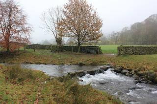 We continued up the tarmac road which passes a few houses, passing also another field of Herdwick Rams, and then onto the fell area proper. The track was well marked, holding to the right of the Burn, I'll give it this name as that is the OS map name. Normally in Cumbria these are Becks or Gills but it must be remembered that it was also a disputed area of Scotland and it should be no surprise that these place names cross over borders.
This track, initially easy to follow petered out into a quagmire route of peat and reeds; it eventually took constant checking of our Satellite mapping system to ensure we were on the marked path. The weather was unduly mild and although we were prepared for anything I stripped to T shirt, Steve ended up bare chested and we had to laugh at how we were now dressed compared to our last three rain lashed outings.
We made the summit of Calf Crag in good time so I asked Steve to take an 'I was here' shot of me at the cairn

 We pressed on and came to the metal fence posts that mark the top of Far Easedale and headed then for Greenup Edge, the high point between Stonethwaite in Borrowdale and Grasmere, when travelling the coast to coast route.


 The only other person on the fells(this seems to be a recurring topic while we are out) was a solitary coast to coaster coming up from Stonethwaite and after some advice on his route in clag and where to sup his beer in Grasmere, we had a hot drink, turned and headed for Wyth Burn. I started this by saying I wanted to 'know' an area and now I 'know'. I had concentrated that much on the actual route we would take, underneath dramatic mountain sides, passing waterfalls and burns, that I had failed to notice an area simply named as The Bog. It's a bit of a giveaway I know, but I missed it and now there was nothing else for it but to traverse this quagmire.


 If nothing else we could laugh at each other as we waded through this. I can only compare it to The Great Moss behind Scafell Pike. Here we were tackling this in the wettest summer we've had in an age and I won't be returning next week! Still the waterfalls at The Bog's end were a sight to behold and the view looking back was really bonny, reminding me of a high plateau like Watendlath, just a tad boggier.


We baited at the footbridge where the two footpaths from Stockhow Bridge meet and decided to alter our plan of going round to Dunmail Raise via footpaths and instead changed to one of them 'as the crow flies' routes straight up from the bridge. This meant a steep incline and I was panting a little by the time we got to the summit There we were with only a downhill section to come, this had meant that having left the clag behind we were back in it again. This route taxed the Achilles tendons but we're used to that now.


The path off Steel Fell back to Greenburn Bottom was tricky to find and we referred to the electronic mapping systems to locate a point where it is worn. Once on it you can't really go wrong, well not navigationally, but if I slipped once on this grassy descent I slipped a dozen times and was very concious of knee ligaments. Even Steve, normally sure footed found it hard to keep upright. We got down with no lasting damage done, just some muddy washing for our wives to tackle. We linked up with our original route and got to the car, a quick roadside change and it was into Grasmere for Tweedies Bar (part of The Dale Lodge Hotel) and some quality beers. I had a Coniston Brewery K7 and a Red something or other which I can't remember it's full name. Both were top quality drinks and I could drink either one all night.

A good outing in mild though misty weather of 16kms with 1050m ascent. I didn't know the routes before, now I do and interesting that they were I'll return when it is a dry summer.
Myself and Steve parked up on A591 just down from The Travellers Rest, Grasmere and commented on the weather not being as clear as it had been when passing Keswick. Still, it was not forecast to rain and it was mild in temperature, though vision limited.

The view from the road toward Stone Arthur.

A dozen Herdwick Rams in the above field.

Looking back after a thankfully dry crossing, well, Holly(The Beast) swam it as usual.
This track, initially easy to follow petered out into a quagmire route of peat and reeds; it eventually took constant checking of our Satellite mapping system to ensure we were on the marked path. The weather was unduly mild and although we were prepared for anything I stripped to T shirt, Steve ended up bare chested and we had to laugh at how we were now dressed compared to our last three rain lashed outings.
We made the summit of Calf Crag in good time so I asked Steve to take an 'I was here' shot of me at the cairn


Someones paying attention, I wonder why?

At this point this was regarded as a brilliant view.

Greenup Edge opening up.

On Greenup Edge looking to Stonethwaite area. Fleetwith Pike with it's distinctive steep slope where they have the Via Ferrata.

Low cloud, masking that which is The Bog.

Wythburn Tarn at The Bog's end.

Looking back on an area that I'll only do again in a dry summer, preferably a drought.
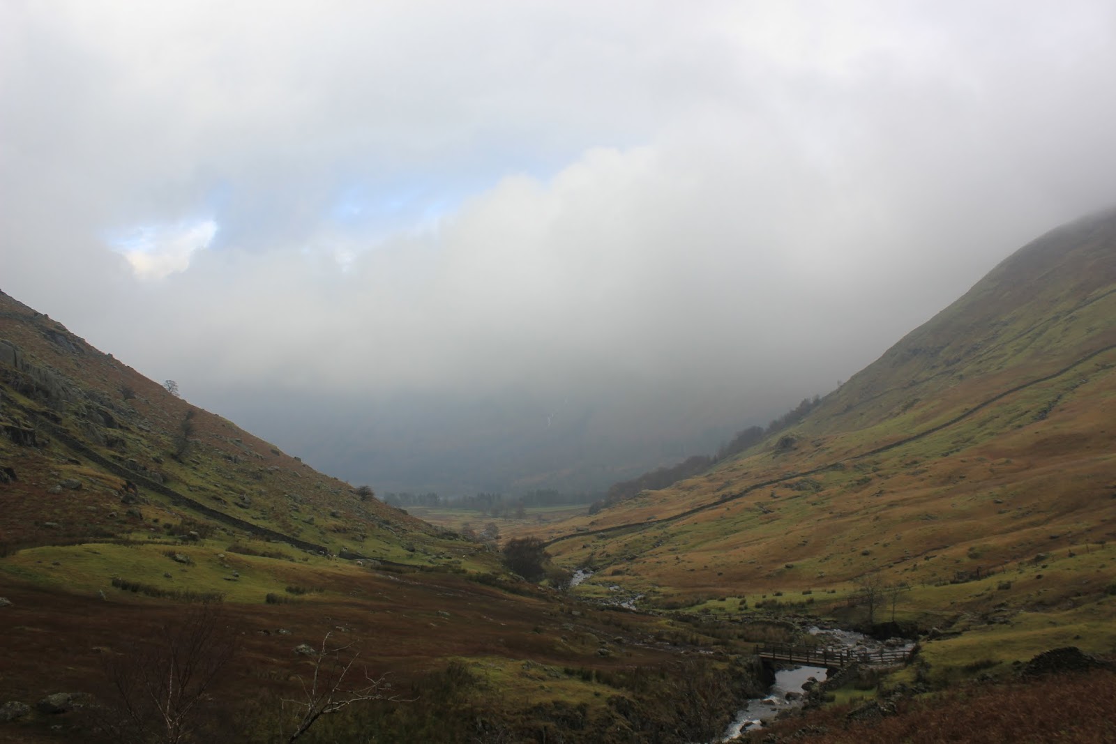
The view down to Wythburn

Lookingt back on the waterfalls.
We baited at the footbridge where the two footpaths from Stockhow Bridge meet and decided to alter our plan of going round to Dunmail Raise via footpaths and instead changed to one of them 'as the crow flies' routes straight up from the bridge. This meant a steep incline and I was panting a little by the time we got to the summit There we were with only a downhill section to come, this had meant that having left the clag behind we were back in it again. This route taxed the Achilles tendons but we're used to that now.

Nearing Steel Fell summit, the most sun seen all day.

Dylan on the summit. The boy done good, Holly is off around somewhere on one of her 'missile speed' sorties.
The path off Steel Fell back to Greenburn Bottom was tricky to find and we referred to the electronic mapping systems to locate a point where it is worn. Once on it you can't really go wrong, well not navigationally, but if I slipped once on this grassy descent I slipped a dozen times and was very concious of knee ligaments. Even Steve, normally sure footed found it hard to keep upright. We got down with no lasting damage done, just some muddy washing for our wives to tackle. We linked up with our original route and got to the car, a quick roadside change and it was into Grasmere for Tweedies Bar (part of The Dale Lodge Hotel) and some quality beers. I had a Coniston Brewery K7 and a Red something or other which I can't remember it's full name. Both were top quality drinks and I could drink either one all night.

A good outing in mild though misty weather of 16kms with 1050m ascent. I didn't know the routes before, now I do and interesting that they were I'll return when it is a dry summer.
Subscribe to:
Posts (Atom)